Nevada Backroaders

Nevada 4-Wheel Drive Club
It is currently Sat Apr 27, 2024 4:57 pm

All times are UTC - 8 hours [ DST ]


Post new topic Reply to topic  [ 42 posts ]  Go to page Previous  1, 2, 3  Next
Author Message
PostPosted: Sun Apr 10, 2011 12:46 pm 
Offline

Joined: Sat Aug 08, 2009 9:03 pm
Posts: 174
Location: Winnemucca, NV
I lived in the Bishop, CA area for over 30 years (until moving to Winnemucca in '08), explored often in the northern Death Valley region, and I know I haven't seen it all ... :wink:

_________________
D.A. Wright
~When You Live in Nevada, "just down the road" is anywhere in the line of sight within the curvature of the earth.


Top
 Profile  
 
PostPosted: Mon Apr 11, 2011 5:38 am 
Offline
User avatar

Joined: Tue Jan 25, 2011 1:16 am
Posts: 111
Location: Vegas
Well, David hopefully I can have that put on my headstone... "here lies Nick, he's seen it all"! :lol:

We were looking at the maps again last night ....do you kow if Silver Peak Rd is passable from the 95 out to Silver Peak (Nivloc Rd)? Just thinking that we may want to go that way to visit Blair on the way up. On Google Maps it looks like a pretty solid trail but right at Silver Peak it looks like it may cross a lake bed or some kind of water??

I did take your warnings about Stateline into consideration as well. I think we'll stay with Herb and then drive to Stateline in the morning, but I have to admit that cabin idea looks really cool too! :D

Now if it were only June!

_________________
2010 Black FJ AT 4WD. Yaesu 2M, Cobra CB, Garmin GPS, PIAA 540 ATP lights.

nick@excopLLC.com

http://www.facebook.com/LasVegasAmsoilDirect

Youtube Exploration channel
http://www.youtube.com/user/FJGhostTowner


Top
 Profile  
 
PostPosted: Mon Apr 11, 2011 8:43 pm 
Offline

Joined: Sat Aug 08, 2009 9:03 pm
Posts: 174
Location: Winnemucca, NV
I've never travelled the road I think you are referring to (turns west off of US95 a few miles north of Goldfield), but know it to be a signed road and maintained. I've travelled over the road due south from Silver Peak down to Lida, as well as the one in from Fish Lake Valley over Oasis Summit (both reached via NV266) without any issues, and found them well bladed. The lake bed you are referrng to is Clayton Valley, which is a mostly dry playa.

_________________
D.A. Wright
~When You Live in Nevada, "just down the road" is anywhere in the line of sight within the curvature of the earth.


Top
 Profile  
 
PostPosted: Wed Apr 13, 2011 5:29 am 
Offline
User avatar

Joined: Tue Jan 25, 2011 1:16 am
Posts: 111
Location: Vegas
Perfect! This is really shaping up to be an awesome couple of days.

I think about the last detail that I have now is the thought of trying to work my way from Stateline/Oriental area across to the trail you were talking about that ends up back on 267. We're going to be visiting that area on the way "out" as oppsed to my original plan of stopping on the way up to Hawthorne.

And.. I did make contact with some of the fine people in Goldfield. Looks like we may get into the high school, but still trying to locate the owner of the hotel. The county people seem to be lost as to the new owner. On a side note, the historical society was given a grant to restore the high school, but the state of Nevada snagged the money from them for "other projects".

_________________
2010 Black FJ AT 4WD. Yaesu 2M, Cobra CB, Garmin GPS, PIAA 540 ATP lights.

nick@excopLLC.com

http://www.facebook.com/LasVegasAmsoilDirect

Youtube Exploration channel
http://www.youtube.com/user/FJGhostTowner


Top
 Profile  
 
PostPosted: Wed Apr 13, 2011 8:48 pm 
Offline

Joined: Sat Aug 08, 2009 9:03 pm
Posts: 174
Location: Winnemucca, NV
I suggest two things:

The BENCHMARK NEVADA ATLAS - Available just about anywhere for around $20 or so. Shows all major roads and many 4x4 trails in the entire state. Good for a quick reference when in the field.

National Geographic TOPO! Nevada topographic map software. Retails for around $100 or so, but I found it online at a reputable map site for $40 last year. Seamless scrolling to and through all topo quads in the state. Can turn on and off street, maintained road and semi-maintained road overlays (tend to get a bit obtrusive when looking at things in detail, but good to check for the best route when there is a maze of similar trails through the same location). Can toggle shading detail off and on for a semi-3D look at the terrain or look at raw USGS quads. And you can look at the maps or "fly over" them similar to Google Earth. Easily links with all GPS units (I have a basic Garmin eTrex). If you have a place to put your laptop, or run a tablet PC in your rig you can hook up a GPS and toss it on the dash and watch in real time where you're going. Or you can save your tracks and import them to the program afterwards to see where you've been. Or you can plot your course into your GPS before hand and have it guide you.

The software can enhance your trip planning and the atlas is the cheapest and easiest to reference and guide you out in the field.

_________________
D.A. Wright
~When You Live in Nevada, "just down the road" is anywhere in the line of sight within the curvature of the earth.


Top
 Profile  
 
PostPosted: Thu Apr 14, 2011 6:04 am 
Offline
User avatar

Joined: Tue Jan 25, 2011 1:16 am
Posts: 111
Location: Vegas
Yep.. I bought the Benchmark some time ago. Already has tattered edges and penciled in notes. :)

Now... the TOP maps! WOW! I get up at 3am for work...so after coffee I started browsing the Nat Geo site and looking at the operating manual and such. I doubt I will have it for this trip, but will be investing in it for my future explorations along with a laptop small enough for the truck.

Again, I can't say enough thanks for the wealth of knowledge you are sharing here, David. I look forward to bringing back some photos and stories to share!

I'll post up the final route once it is all laid out.

Thank you again!

_________________
2010 Black FJ AT 4WD. Yaesu 2M, Cobra CB, Garmin GPS, PIAA 540 ATP lights.

nick@excopLLC.com

http://www.facebook.com/LasVegasAmsoilDirect

Youtube Exploration channel
http://www.youtube.com/user/FJGhostTowner


Top
 Profile  
 
PostPosted: Thu Apr 14, 2011 7:13 pm 
Offline
User avatar

Joined: Tue Jan 25, 2011 1:16 am
Posts: 111
Location: Vegas
I talked to Herb today for almost an hour! (the "owner" of Goldpoint). He's going to be out of town during our visit but has us set up with a camp spot and some great info on the area.

David...he says don't be a stranger! ::)

_________________
2010 Black FJ AT 4WD. Yaesu 2M, Cobra CB, Garmin GPS, PIAA 540 ATP lights.

nick@excopLLC.com

http://www.facebook.com/LasVegasAmsoilDirect

Youtube Exploration channel
http://www.youtube.com/user/FJGhostTowner


Top
 Profile  
 
PostPosted: Fri Apr 15, 2011 7:07 am 
Offline

Joined: Fri Dec 05, 2008 9:42 am
Posts: 25
Hi Guys,
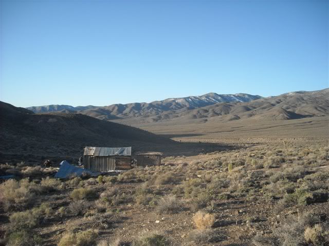
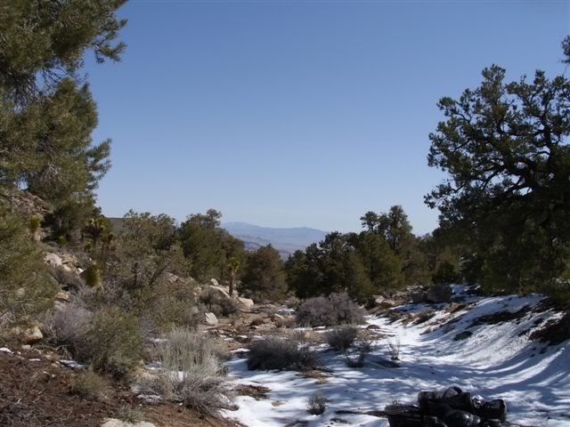
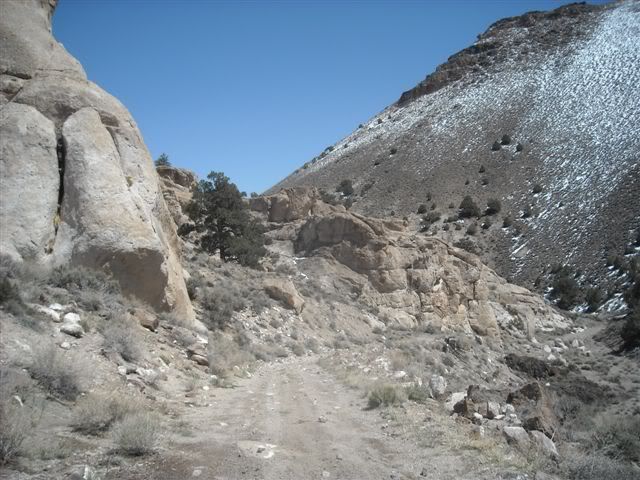
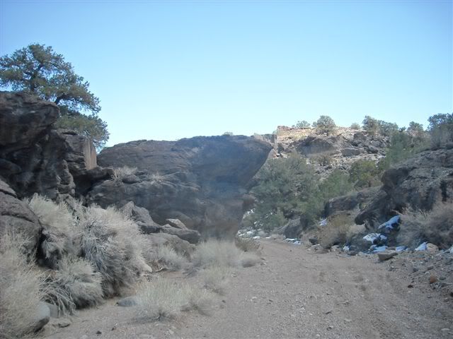
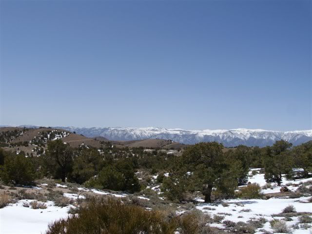
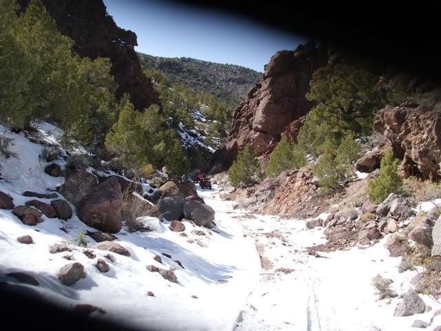
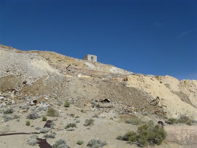
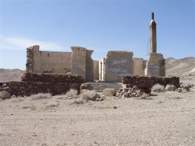
I don't get over here very often but I looked the other day and saw this thread. This is an area I have been exploring for years. You will enjoy it guaranteed! Awesome area with lots to explore. A couple of questions have been asked about Silverpeak Road out of Goldfield. It is absolutley passable year round. The "Lakes" you see on the maps are Lithium pools but the road is raised above. No problem. Once you get to Silverpeak, you can take Coyote Rd and that leads all the way to fish lake valley. Again, no problem. I wish I had time right now to post more pics of some of the extraordinary roads and canyons I have found over the years. This is an amazing county! I will post more this weekend after I can dig them up. Stay tuned.

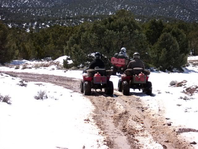
Some buds from Cali (I live in Vegas) are coming up next month. We are doing a 3 day trip 5/7-9. We are meeting in Silverpeak this time and leaving the rigs there. (I have also met several people from Silverpeak over the years too) There will be me on my Quad, 2 side by sides and one CJ. When is your trip planned?

As for the Serriff...when we explore off the quads, the guys let us park our rigs in their yard at the courthouse while we are out on the trail. We have left them there for several days at a time. They are a very friendly bunch and we have gotten to know them well. If you need to contact them, I have several cell numbers I can pass along. If you need help, just IM me and I will get you the info.

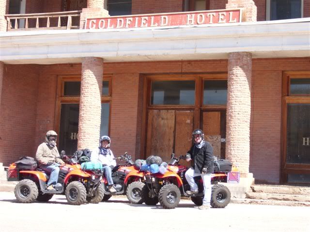
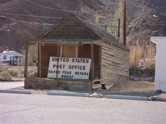
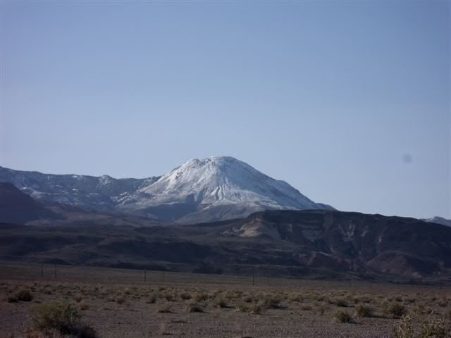
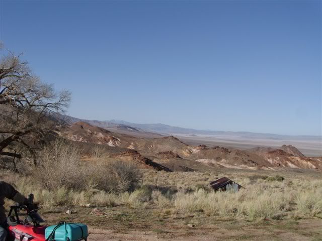
To give you a taste, here is a repost of a thread I started here back in April of 2009 to give you an idea of what you will be seeing............

http://nevadabackroaders.com/phpbb3/viewtopic.php?f=10&t=2211&p=16912#p16912

RKBA wrote:
Hi All,
I wanted to share with everyone some information about an area I love. I keep getting drawn back to Esmeralda County for some reason. I first visted the area about 6 years ago after a BLM ranger suggested I go and do some exploring there. The entire county has less than a thousand people living in it and is the definition of remote but easy to get to from Vegas. There are still many, many areas I haven't gotten to yet and expect to go back often.

A few months ago, I started planning another camping trip there. This time, me and a couple of buds are going to take the ATVs out for 4 days and explore some of the old and long abandoned mining towns and camps. This is going to be a challenging trip as we have to live off the ATVs with no outside support. All food, fuel, water etc will have to be carried on the quads.

A few weeks ago, my 16 year old son was on spring break. He and a few of his friends (all of whom I have taken camping before) wanted to go camping for a few days. I decided to use this opportunity to do a little recon work and scout out the route to a couple of my planned ATV destinations. The Mohawk Mine was one of these. I have known about this place for a long time but never gone. This mine operated until the early sixties and was said to be very intact as it has had few visitors. I had no idea how true this was. The place is a time capsule right down to 45 year old newspapers still sitting on tables. We saw many other sites during this short trip and I wanted to share some pictures.

In case anyone is iterested, our 4 day trip is planned next month. We are leaving Vegas Thursday afternoon May 7 and will spend the night in Goldfield. The Sheriff is letting us park our rig in their lot. We will leave at dawn on Friday and return Monday late afternoon to be back in Vegas that evening. We are planning on camping at Mohawk Saturday night. If anyone wants to join us, we can meet in Silverpeak that morning and I can guide to the mine site. Here is a map of the route:

Image

Pics of the Mohawk and surrounding area:

Image
Image
Image
Image
Image
Image
Image
Image
Image
Image
Image
Image
Image
Image
Image
Image
Image

Here is an old ranch we came across on the way down the mountain:

Image
Image
Image
Image
Image
Image

Now we are heading to Nivloc. This is a super cool mine that shut down in the 20s

Image
Image
Image
Image
Image
Image
Image
Image
Image
Image


Top
 Profile  
 
PostPosted: Fri Apr 15, 2011 10:09 am 
Offline

Joined: Sat Aug 08, 2009 9:03 pm
Posts: 174
Location: Winnemucca, NV
I almost mentioned the Mohawk Mine, but decided not to. Too many good things to see in the entire region, but the original trip was to hit this stuff along the way to or fro from Bodie and Aurora, not be a trip in itself ... at least for now ... :wink:

However, the Mohawk is like a trip back in time and some of the things I found there amaze me that even though Esmeralda County passes a grader through here annually and that the roads are good enough for a 2WD pickup, stuff is still there as left in the 1960s. The Mohawk is one of the few mines that I ventured in a few hundred feet to a central cavern filled with equipment for a photo (then left post haste as I'm not into being in mines) and a friend of mine spent an hour exploring the interior of the main mine and getting to several levels (we have a plan - we choose a time that he'll be out, I stay outside and if he doesn't show up within an hour after our planned time I go for help). The camp is pretty intact and in reasonably good shape. There is a superb view found nearby that overlooks Clayton Valley, Silver Peak and the territory in a 180 degree arc eastward. On the lower reaches of the range along the two main acesses north from the road in from Fish Lake Valley there are several scenic abandoned ranches, springs, interesting geology, and views.

From your photos it appears you went in at a similar time that I did, in the spring of 2003. The Esmeralda County grader was grading the roads in the Mohawk area when I visited. Snow dotted the forest but the roads were dry.

_________________
D.A. Wright
~When You Live in Nevada, "just down the road" is anywhere in the line of sight within the curvature of the earth.


Top
 Profile  
 
PostPosted: Fri Apr 15, 2011 10:59 am 
Offline
User avatar

Joined: Tue Jan 25, 2011 1:16 am
Posts: 111
Location: Vegas
I can already see that this area will take more than one visit to get my fill! Thanks for the great photos and trail report. Looks like a great addition to my exploration list!

_________________
2010 Black FJ AT 4WD. Yaesu 2M, Cobra CB, Garmin GPS, PIAA 540 ATP lights.

nick@excopLLC.com

http://www.facebook.com/LasVegasAmsoilDirect

Youtube Exploration channel
http://www.youtube.com/user/FJGhostTowner


Top
 Profile  
 
PostPosted: Sat Apr 16, 2011 7:14 am 
Offline

Joined: Fri Dec 05, 2008 9:42 am
Posts: 25
DesertRat wrote:
I can already see that this area will take more than one visit to get my fill!


You have no idea DesertRat! :D

As promised, here are some more pics from other trips.................

Image
Image
Image
Image
Image
Image
Image
Image
Image
Image
Image
Image
Image
Image
Image
Image

Well, thats all for now. I have lots more but you get the idea. DesertRat, I have most of the interesting sites in this area logged with GPS coordinates. You are welcome to them. It might save you some time as you make your way up towards Aurora and Bodie. Just let me know and I will get them to you.

Good luck and have fun!!


Top
 Profile  
 
PostPosted: Sat Apr 16, 2011 2:10 pm 
Offline
User avatar

Joined: Tue Jan 25, 2011 1:16 am
Posts: 111
Location: Vegas
Wow! Beautiful photos! All the more inspiring for my trip. I don't think I have been this enthused about anything in a long time. :) I'll PM you for those corrdinates for sure! That would be very helpful!

Headed off to Big 5 now to add a few more pieces to the puzzle. They are having a huge sale right now. :lol:

_________________
2010 Black FJ AT 4WD. Yaesu 2M, Cobra CB, Garmin GPS, PIAA 540 ATP lights.

nick@excopLLC.com

http://www.facebook.com/LasVegasAmsoilDirect

Youtube Exploration channel
http://www.youtube.com/user/FJGhostTowner


Top
 Profile  
 
PostPosted: Sun Apr 17, 2011 1:45 pm 
Offline
User avatar

Joined: Tue Jan 25, 2011 1:16 am
Posts: 111
Location: Vegas
Well I think this is going to be the final plan for this trip:

Leaving JUNE 10 at about 0400. Heading straight to Goldfield. We'll spend some time there and hope to gain access to the hotel by then. From Goldfield we're headed up to Silver Peak then Blair. We'll head out from there to stop for a bit it Coaldale. From Coaldale we'll go to Candelaria and Belleville and off to Mina and Sodaville. We'll camp for the night either in Hawthorne or somewhere along Lucky Boy Pass. (not sure just yet)

The next day we'll head across to see Aurora and Fletcher and down to Bodie. After we're done at Bodie, we're headed south to Big Pine to get 168 back over to Nevada and on to 266 to Lida and then on to Gold Point. Herb is going to be out of town but has already made arrangements with one of the town keepers for us to stop in and say hello. We're planning on camping at Stateline if the cabin is empty. If not, we may still stay in the tent there.

That next morning we're headed out to see the Hardluck Mine castle and Rattlesnake mines and then to Belleville. After Belleville, it's back over to 95 and back home.

I already know we'll be going back there many times! This is just going to kind of scratch the surface for sure, but I think it will be a fun couple of days!

_________________
2010 Black FJ AT 4WD. Yaesu 2M, Cobra CB, Garmin GPS, PIAA 540 ATP lights.

nick@excopLLC.com

http://www.facebook.com/LasVegasAmsoilDirect

Youtube Exploration channel
http://www.youtube.com/user/FJGhostTowner


Last edited by DesertRat on Tue May 17, 2011 11:40 am, edited 1 time in total.

Top
 Profile  
 
PostPosted: Sun Apr 17, 2011 4:45 pm 
Offline

Joined: Sat Aug 08, 2009 9:03 pm
Posts: 174
Location: Winnemucca, NV
Quote:
We'll head out from there to stop for a bit it Coaldale.

Nothing to stop for in Coaldale any longer that I know of. Except maybe to see the railroad grade of the long abandoned Tonopah & Goldfield Railroad (you'll also be travelling along the long abandoned Silver Peak Railroad as well as you travel from Blair north to US6). I think I recall a bar and gas station there decades ago, but I don't think anything is left standing today. It's been a few years since I've passed by (2006).

Quote:
then on to Gold Point. ... we're headed out to see the Hardluck Mine castle and Rattlesnake mines ...

I'd suggest getting copies of Alan Patera's WESTERN PLACES - HORNSILVER / GOLD POINT NEVADA and WESTERN PLACES - GOLD MOUNTAIN, NEVADA. They are available online at Alan's website at http://www.westernplaces.net/ I took Alan through the region, he and I've travelled quite a bit together, and we collaborated on one book together and I've contributed to many of his other WESTERN PLACES series of books.

I don't know if the main structure at the Rattlesnake Mine is still standing. It was pretty feeble when I visited in 2003. It would be best if you walked the last third of a mile into the camp, unless you have at least a rear locking differential and some ground clearance. Randy Johnston at the Hardluck castle or Herb can guide you there.

_________________
D.A. Wright
~When You Live in Nevada, "just down the road" is anywhere in the line of sight within the curvature of the earth.


Top
 Profile  
 
PostPosted: Mon Apr 18, 2011 4:03 pm 
Offline
User avatar

Joined: Tue Jan 25, 2011 1:16 am
Posts: 111
Location: Vegas
Now, I had heard that as recent as 2009 there were remians of the modern era buildings still there. (the bar, gas station and little motel) If they are there, I'd like to do stop and shoot some photos. Just something a little different.

I looked at Alans books and more than likely will add a lot of the Western Places books to my collection. I purchased a few from Robert C Jones and quite frankly I was dissapointed in the books for the almost $60 I invested in nothing more than a few pamphlets.

Hopefully we find something to see along the trail to the Rattlesnake. I am sure we'll find something! :lol:

I owe you guys a ton of thanks for all the information! Now if June would just get here!

_________________
2010 Black FJ AT 4WD. Yaesu 2M, Cobra CB, Garmin GPS, PIAA 540 ATP lights.

nick@excopLLC.com

http://www.facebook.com/LasVegasAmsoilDirect

Youtube Exploration channel
http://www.youtube.com/user/FJGhostTowner


Top
 Profile  
 
Display posts from previous:  Sort by  
Post new topic Reply to topic  [ 42 posts ]  Go to page Previous  1, 2, 3  Next

All times are UTC - 8 hours [ DST ]


Who is online

Users browsing this forum: No registered users and 36 guests


You cannot post new topics in this forum
You cannot reply to topics in this forum
You cannot edit your posts in this forum
You cannot delete your posts in this forum
You cannot post attachments in this forum

Jump to:  
Powered by phpBB® Forum Software © phpBB Group