Nevada Backroaders

Nevada 4-Wheel Drive Club
It is currently Sat Jun 01, 2024 10:22 pm

All times are UTC - 8 hours [ DST ]


Post new topic Reply to topic  [ 8 posts ] 
Author Message
PostPosted: Tue Feb 10, 2009 10:49 pm 
Offline

Joined: Tue Jan 13, 2009 1:31 am
Posts: 82
my brother and I went up to redrock in the snow to see how far we could go. almost made it to the top but had to turn around due to the trail being too narrow and too slippery. we were soooo close too and we were the first vehicles to go as far as we did, cutting through the powder.

not too much snow in the beginning:
Image

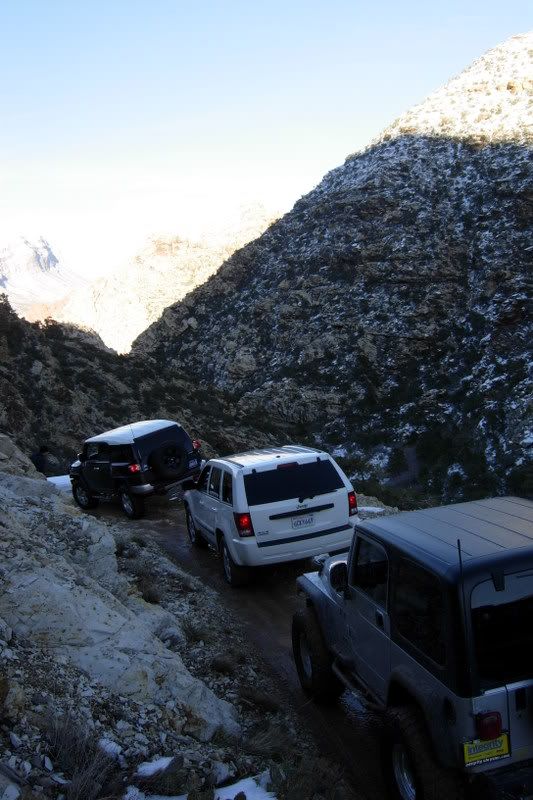
then there was a little snow and a lot of mud:
Image

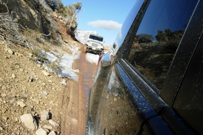
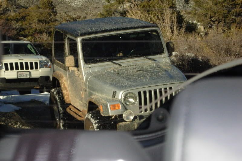
the guy in the back was from canada, taking his rental jeep out for probably its first and last adventure:
Image

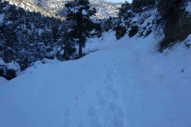
only the dogs and our own footprints in front of us to disturb the snow:
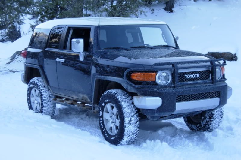
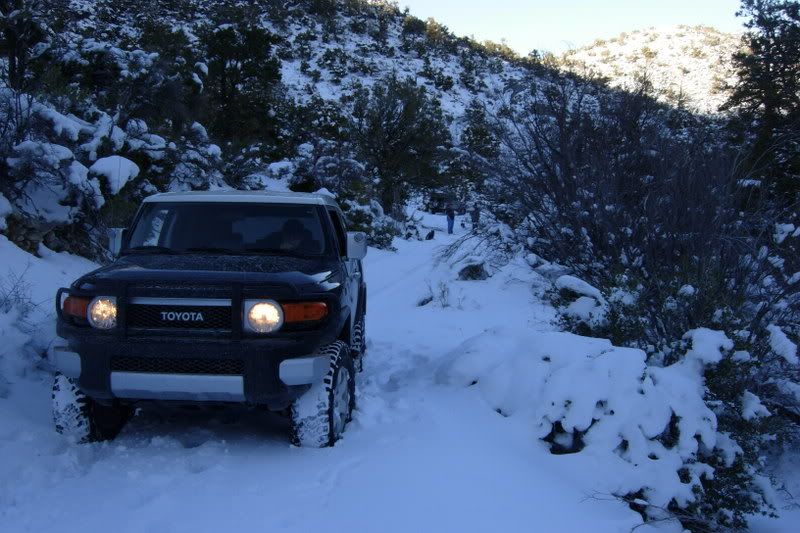
Image

heres my bros FJ:
Image

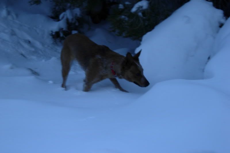
Shiva trying to figure out what snow is (it was the dogs first time in snow)
Image

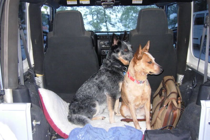
Zorro and Shiva chillin in the back of the jeep:
Image

this is where we stopped. you can see my jeep down the hill after I backed up and turned around:
Image

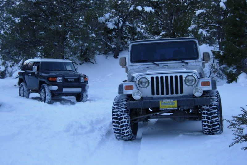
I like this pic for some reason:
Image

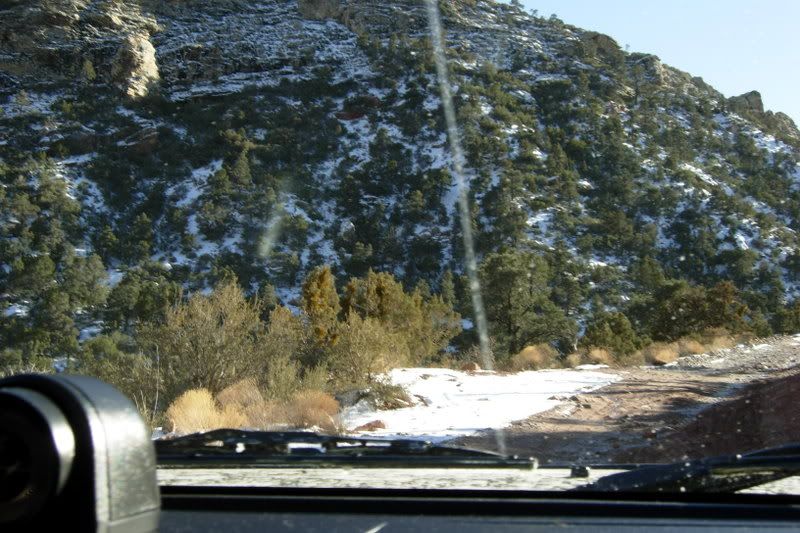
cool pic on the way back down:
Image


Top
 Profile  
 
PostPosted: Wed Feb 11, 2009 8:52 am 
Offline
User avatar

Joined: Sun Nov 23, 2008 3:07 pm
Posts: 148
Location: Henderson
Hey looks like lots of fun. Nice New Jeep.

I have been out to redrock for sightseeing, driving the scenic loop, etc..

My question where is this road/trail/name. I would like to try it sometime.

thanks
Kelly aka Mr. D

_________________
Kelly aka Mr. D

04 Rubicon;66 F100


Top
 Profile  
 
PostPosted: Wed Feb 11, 2009 12:20 pm 
Offline

Joined: Tue Jan 13, 2009 1:31 am
Posts: 82
its most of the way around the scenic loop. I think you get off at the white pine parking area if I remember right (if you get to icebox canyon you passed it). then you just start driving up, there is a split in the trail not too far in, to the right it says madre mountains, but you wanna stay left. at the top there are a couple hiking trails as well. I would recommend going back down the same way you went up unless you have some people with you to go down rocky gap.

I think JJ probably knows the name of the trail head where you turn off for sure, since Ive only been up there a couple times.


Top
 Profile  
 
PostPosted: Wed Feb 11, 2009 5:55 pm 
Offline
User avatar

Joined: Thu Dec 08, 2005 12:45 pm
Posts: 747
Location: Las Vegas
that road in the park is labelled Rocky Gap.

four wheelers locally call it Potato Ridge, or just Potato, due the HUGE boulders you find on the back half.

from the Vegas side, you go into the park and drive to, I believe, the White Rock turnoff, and at the end of pavement it turns into the 4x4 road.

from the other side, you need to drive towards Pahrump and take the Lovell Canyon Road exit and follow that down till there is a fairly obscure exit going east. There you find the infamous rock garden.

_________________
Image


ɹǝʌo ǝɯ ןןoɹ sıɥʇ pɐǝɹ uɐɔ noʎ ɟı


Top
 Profile  
 
PostPosted: Wed Feb 11, 2009 6:21 pm 
Offline
Site Admin
User avatar

Joined: Tue Sep 30, 2003 11:00 am
Posts: 791
Location: Las Vegas again
just being uncle brad here. :) the turn off of the scenic loop is actually the one after white rock and it's the willow spring picnic area/lost creek loop turn at approx. mile 7.5 of the loop. glad to hear you guys played it safe and turned around before entering the garden. with that much snow hiding the rocks and holes it could have made for a long cold hike to get a cell signal to call for help. and trust me, lots of people have made that hike as blm does not send rangers to check for stuck 4 wheelers. when you hit the end of the blacktop past the willow creek picnic area you see the big sign stateing it's not a county maintained road and they mean it. i've seen rigs on 39 inch tires fully locked with mucho experianced drivers not make it thru the rock garden after a snow like that. 8)

_________________
1994 jeep yj wrangler-"d.d." []lllllll[]
Retired Trail Boss and Website Director
Founder of Uncle Brad's Misguided Children
NVBROFC
Re-located from my beloved Mojave to Texas. Where did all the mountains go???


Top
 Profile  
 
PostPosted: Wed Feb 11, 2009 6:44 pm 
Offline
User avatar

Joined: Thu Dec 08, 2005 12:45 pm
Posts: 747
Location: Las Vegas
oh Willow Spring. I guess that's why I always get lost out in the boonies.

I can't even remember marked pathways.

_________________
Image


ɹǝʌo ǝɯ ןןoɹ sıɥʇ pɐǝɹ uɐɔ noʎ ɟı


Top
 Profile  
 
PostPosted: Wed Feb 11, 2009 7:07 pm 
Offline
Site Admin
User avatar

Joined: Tue Sep 30, 2003 11:00 am
Posts: 791
Location: Las Vegas again
what do you expect jj? you've been hanging around me too long. i had to get my old map of the loop to get it right. :lol:

_________________
1994 jeep yj wrangler-"d.d." []lllllll[]
Retired Trail Boss and Website Director
Founder of Uncle Brad's Misguided Children
NVBROFC
Re-located from my beloved Mojave to Texas. Where did all the mountains go???


Top
 Profile  
 
PostPosted: Wed Feb 11, 2009 10:08 pm 
Offline
User avatar

Joined: Sun Nov 23, 2008 3:07 pm
Posts: 148
Location: Henderson
right on thanks. I will save the later half to do with a group.

_________________
Kelly aka Mr. D

04 Rubicon;66 F100


Top
 Profile  
 
Display posts from previous:  Sort by  
Post new topic Reply to topic  [ 8 posts ] 

All times are UTC - 8 hours [ DST ]


Who is online

Users browsing this forum: No registered users and 8 guests


You cannot post new topics in this forum
You cannot reply to topics in this forum
You cannot edit your posts in this forum
You cannot delete your posts in this forum
You cannot post attachments in this forum

Jump to:  
Powered by phpBB® Forum Software © phpBB Group